
Share This

We’re all pretty familiar with the way the world looks on maps, it’s imagery we’ve all seen thousands of times from school through to adulthood. So when someone shows you how countries look when the filter is changed, cartography suddenly becomes something much more interesting.
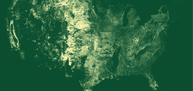
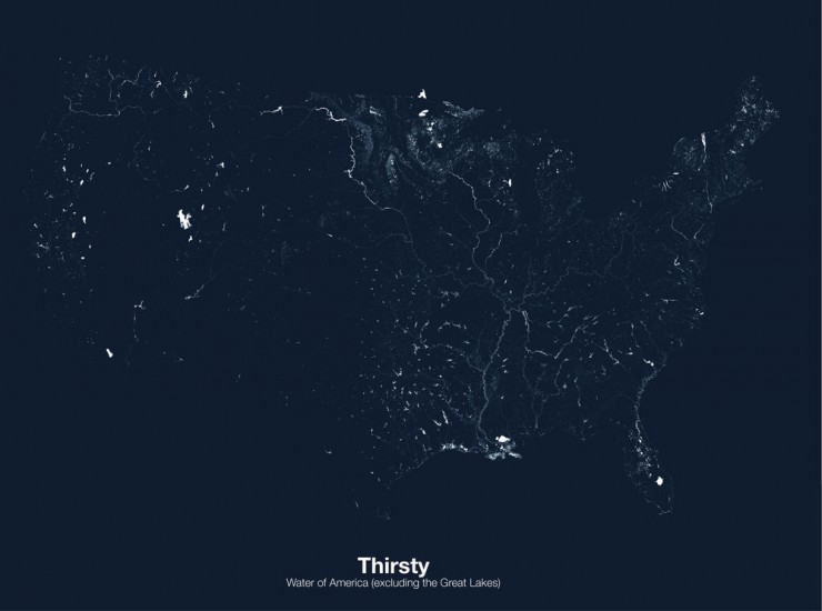
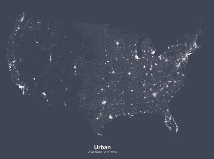
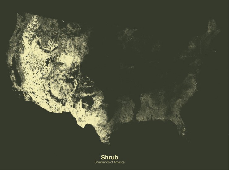
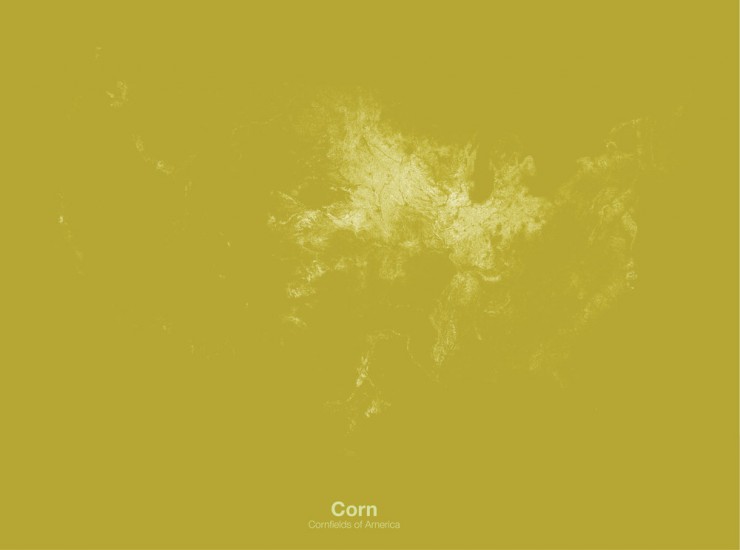
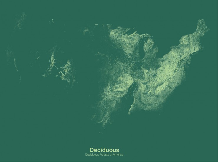
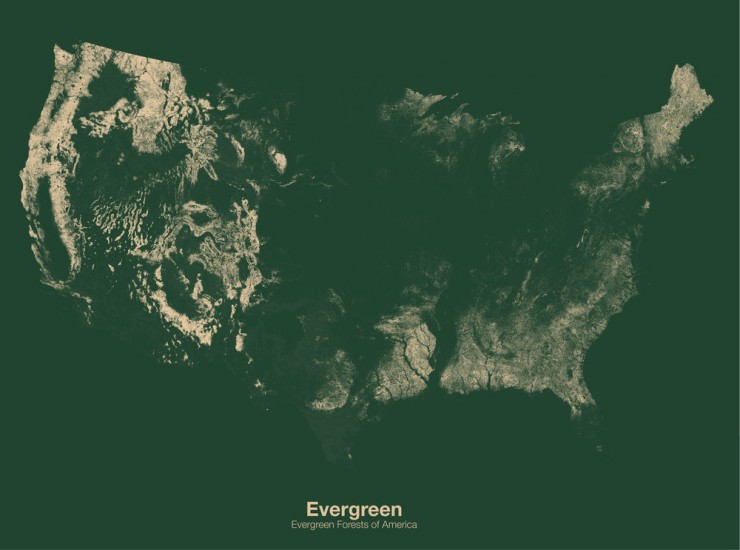
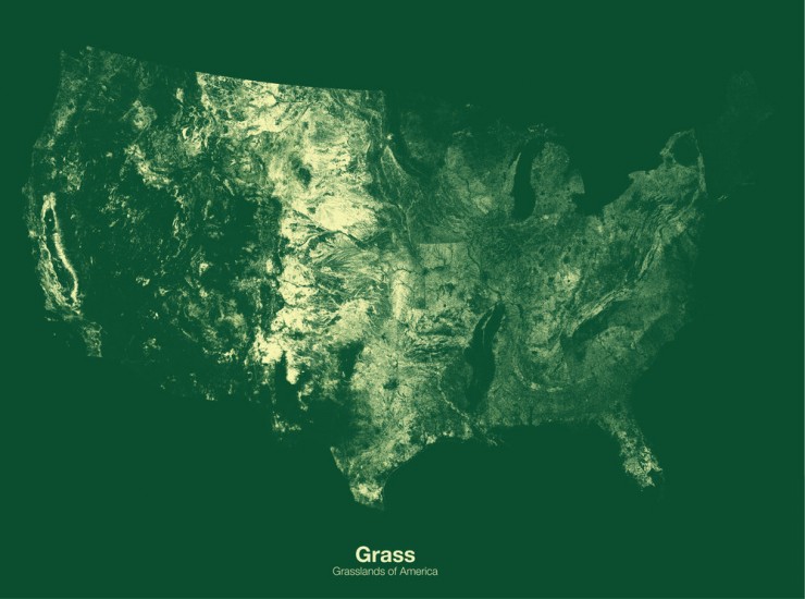
These minimalist maps from London-based designer Michael Pecirno are part of an ongoing project to reveal and understand the hidden landscapes of the world. The results are striking, incredibly interesting and, in my opinion, beautiful.
Each map visualises America (actually, the lower 48 states) using specific filters, detailing features such as bodies of water, urbanised areas, grasslands, corn and much more, all with data takes from the USDA (US Department of Agriculture). Personally I love them, and can’t wait to see more work from Mr Pecirno.


Leave a Reply